Northwoods Memories Multimedia Productions
Pictograph Bulletin Information
Each booklet is 4 pages, 8 1/2” x 11” in size and is printed by Fisher Maps on waterproof paper with waterproof inks. Most sheets feature only one site, but where two fairly simple sites are nearby, they both may appear on one bulletin.
Page 1
Every booklet is based on our own personal visit to the sites, and all photographs were taken by us over the last 33 years of paddling canoe country.
- A complete series of information booklets on the known pictograph and petroglyph sites in Quetico Provincial Park and the Boundary Waters Canoe Area.
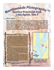
- On page 1 is accurate directions for finding the site based on our own personal visit to the site.
- A Fisher map image shows the exact location of the site (printed with permission of Fisher Maps).
- An important note describes the significance of pictographs to the Ojibwa. Respect the sites!
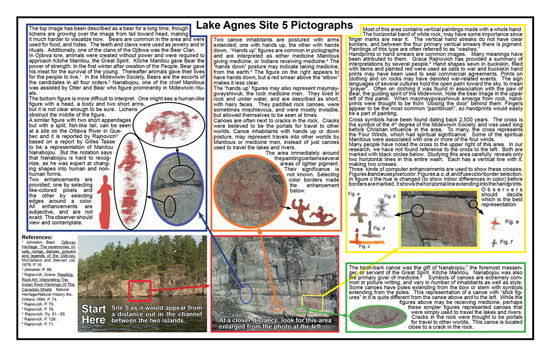
- On pages 2 & 3 is a picture of the site from far away to aid in paddling directly to the site.
- A close-up picture aids in finding pictograph locations on the rock face.
- Pictures of the individual images with color-coded locations on the panel aid in finding every image.
- Computer enhancements, where appropriate, assist with images that are difficult to see.
- Written material about the individual images and their significance, helps in learning about the symbols.
Pages 2 & 3
Page 4
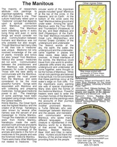
- On page 4 is an article on the Ojibwa culture, spiritual implications, or another topic related to pictographs. No two sheets contain the same article. All articles include bibliography for additional reading.
- When there are several sites on one lake, a Fisher map image is included showing all sites on the lake.
- Bibliographic references provide opportunities for additional reading.
- “Contact Us” information is for your use.
Last year we took our then 8-year-old daughter Lucy for her first trip into Quetico on the S-chain, Agnes, Jeff Lake loop and did she enjoy it. She never complained a bit, even while enduring the many clouds of mosquitoes and many portages the first day up to Silence last June. Finding the pictographs using your bulletins was easy and contributed greatly to the success of that trip with her. She can't wait to go back! It's never too early to start them. In a week we'll be taking our second daughter, Kristina, and hoping for another memory filled trip.
Dave Kaufman
Wisconsin
Visit the sites!
Respect the sites!
Learn at the sites!